
Technique · FIELD COVERAGE
How to grid a field for metal detecting
Plan repeatable search lanes on a permitted UK field, choose sensible overlap, record coverage and avoid missed strips or unnecessary ground disturbance.
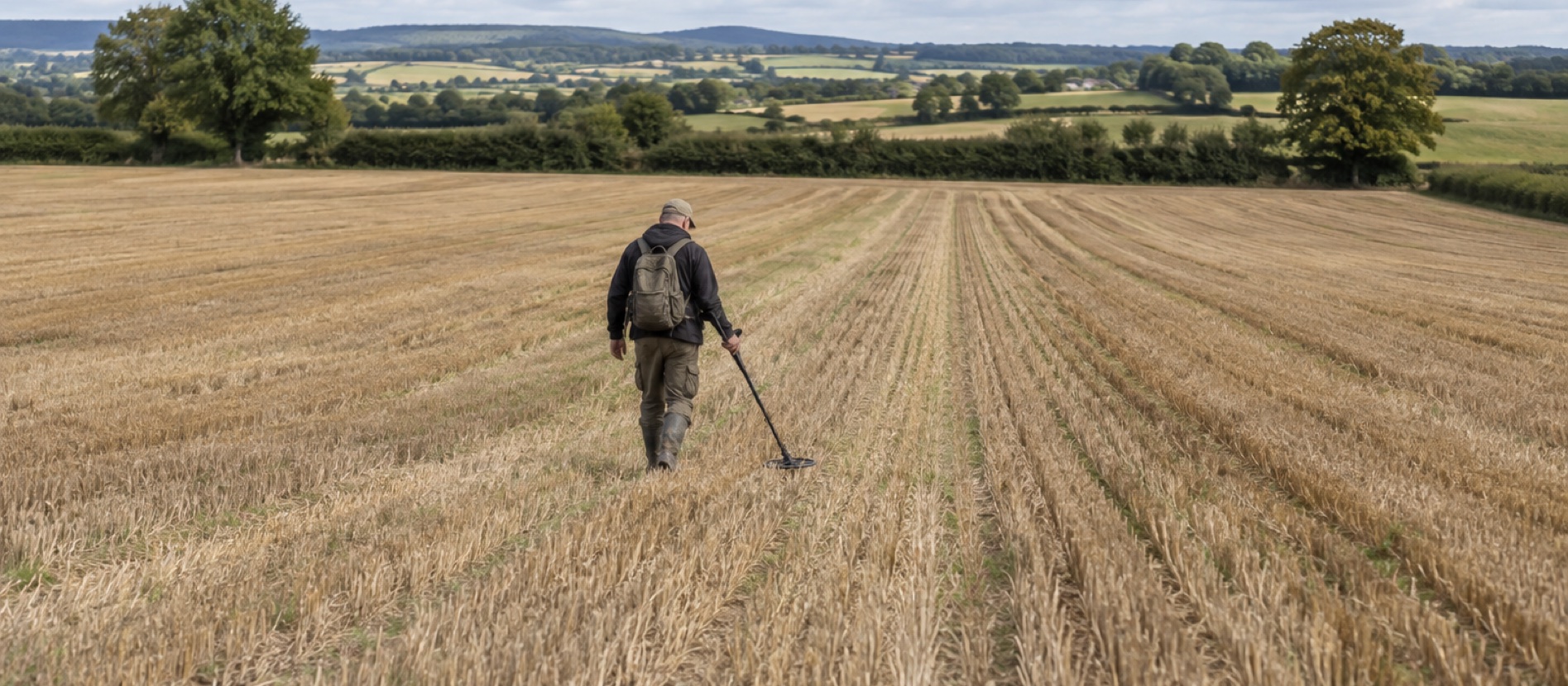
Use headlands, hedge corners or lawful temporary markers as lane references.
Keep the coil low and level; account for its real search width, not just its plastic diameter.
Record coverage, conditions and finds so a later visit can revisit a patch deliberately.
Start with the permission boundary
Before choosing a lane direction, ask which field, entrances, dates and recovery depth the owner or authorised occupier has agreed. Mark out no-go areas: standing crop, stock, active machinery, known archaeology, environmental margins and any protected designation. Permission for an entire farm is not implied by access to one field. The England and Wales checklist explains the wider checks.
Historic England's agri-environment guidance warns that agreements can restrict detecting where archaeology, habitat or ground-nesting birds may be affected. Do not turn a visible field-edge feature into a search target before the manager confirms it is in scope.
Make blocks small enough to finish
A large field is easier to search as several named blocks than as one vague rectangle. Use features that will still be visible next time: two hedge corners, a gate and a tree, or a mapped field boundary. Draw a simple sketch in a notebook or offline map. Give each block a short code such as A1, A2 and B1, then record a start and end point.
Walk a first orientation line between two safe fixed references. If the field is irregular, let the boundary define one side and accept that the final lane will be shorter. Do not plant stakes without the land manager's agreement or leave tape, flags or string behind. A phone track can help remember coverage, but GPS drift is too large to prove every coil-width strip was searched.
Choose a lane direction that supports a level sweep
On short stubble or lightly cultivated ground, align lanes with the safest walking direction and easiest reference points. Furrows may make following a line simple, but a coil tilted across ridges loses effective proximity to the soil. On a slope, choose a route that keeps footing secure, even if it is less geometrically neat. Avoid driving a spade into roots or banks to force a rectangular plan.
When the surface varies, assess soil moisture and weather before starting. Sticky, wet soil makes neat recovery harder; tall stubble may hold the coil above the ground. A technically tidy grid is pointless if the surface cannot be reinstated safely.
Overlap sweeps and lanes
The nominal width of a coil is not the width at which every small target can be heard equally well. The response is often strongest nearer its centre and changes with target depth, soil and sweep height. Overlap each arm swing visibly rather than letting the outer coil edges just touch. As you step forward, do not allow gaps between consecutive arcs.
For the next walking lane, take a cautious step sideways from the previous track and overlap the previous search strip. There is no universal lane spacing: a small coil, tall stubble or difficult ground requires a tighter pattern than a broad coil on clean, level soil. Begin conservatively and adjust only after a surface-target check shows that your chosen spacing still gives a repeatable response. The sweep guide covers posture and coil control.
Keep a simple coverage record
At the end of each lane or block, note the field code, direction, detector mode, coil, ground condition and whether the block was complete. Record find positions accurately enough for later reporting. A find at the intersection of two vague phone tracks is less useful than a grid reference, photo and block note taken before lifting it.
Keep modern rubbish separate from objects you may need to record. A divided pouch can protect an individual find from being rubbed by iron scraps or spade grit; a bag is not a substitute for labelling its location. How to record a find explains the details worth keeping.
Change scale when the field changes
A broad reconnaissance grid may reveal a concentration of repeatable signals near a former path or gate. Stop and draw a smaller block around it rather than wandering toward each new tone. Search tighter lanes and consider a second pass at right angles. The second direction can expose a target that lay beside iron relative to the original sweep.
Do not assume a find cluster is a licence to dig deeper. A compact layer, associated objects or structural material may indicate an archaeological context. Follow the landowner agreement, record what is visible and contact a Finds Liaison Officer where appropriate.
A practical first-session pattern
- Confirm the permitted block and no-go boundaries with the land manager.
- Choose two visible end references and walk one straight trial lane.
- Check a known surface target at the edge of the planned overlap.
- Search parallel lanes slowly, noting incomplete strips around obstacles.
- Recheck a small productive patch from a second direction.
- Record completed blocks and restore all permitted recoveries before leaving.
This gives you something more valuable than a claim of having “done the field”: a clear record of where you have searched, how you searched it and what remains for another safe visit.
Common questions
Frequently asked questions
What is the best way to grid a field for metal detecting?
Divide the permitted area into named blocks, use fixed end landmarks, walk parallel lanes with overlapping coil sweeps and record completed strips. Revisit promising patches from a second direction.
How far apart should metal detecting lanes be?
There is no universal spacing. Coil size, target depth, ground and stubble change effective coverage. Start with generous overlap and use a known surface target to check that the edge of each lane is still audible.
Can a phone GPS track prove complete coverage?
No. Consumer GPS drift is much wider than a coil, and a track does not show sweep overlap. Use it as a memory aid alongside landmarks and block notes.
Should I grid a find-rich patch more closely?
Yes, if the landowner permits continued searching and recovery. Draw a smaller block, slow down and record locations. Stop if finds appear associated with a compact archaeological layer.
Helpful products
A manageable field setup
A light detector and a divided finds pouch suit long, measured lanes. Choose either for its practical role rather than expecting equipment to compensate for poor overlap.

Mid-range
Minelab VANQUISH 360
Best for: Parks, fields and beaches for a beginner who wants simple controls and one detector for varied ground.
- Multi-IQ simultaneous multi-frequency
- Whole detector to 5 m (IP68)
- 1.16 kg
Automatic simultaneous multi-frequency operation, a low 1.16 kg weight and full 5 m waterproofing make this the least complicated route into mixed UK ground.
Know before buying: The deliberately simple control set offers less room to tune audio and recovery behaviour than the X-TERRA PRO.

All-round field pouch
XP Finds Pouch
Best for: Regular field and wet-weather searches where quick debris storage and a separate protected pocket matter.
- Open pocket plus zipped pocket
- Washable with water drainage
- Belt, strap or MOLLE mounting
A washable belt pouch with an open debris compartment, a zipped pocket for better finds, drainage and MOLLE attachment points for a pinpointer holster or lanyard.
Know before buying: The open section is for robust scrap, not fragile objects; use a rigid finds box inside the zipped area for coins and delicate artefacts.